Nebbi District is a district in Northern Uganda. It is named after its main municipal, commercial and administrative centre, Nebbi, the location of the district headquarters.

Katakwi District is a district in the Eastern Region of Uganda. The town of Katakwi is the site of the district headquarters.
Kamwenge District is a district in Western Uganda. It is named after its 'chief town', Kamwenge, where the district headquarters are located. Kamwenge District is part of the Kingdom of Toro, one of the ancient traditional monarchies in Uganda. The kingdom is coterminous with Toro sub-region. The districts that constitute the sub-region are: (a) Bunyangabu District (b) Kabarole District (c) Kamwenge District (d) Kyegegwa District (e) Kitagwenda District and (f) Kyenjojo District.

Kanungu District is a district in the Western Region of Uganda. The town of Kanungu is the site of the district headquarters. The Bwindi Impenetrable Forest in Kanungu District is among the sites shown in aerial footage in the movie Black Panther.

Fort Portal or Kabarole is a city located in the Western Region of Uganda. It is the seat of both Kabarole District and historically of the Tooro Kingdom.

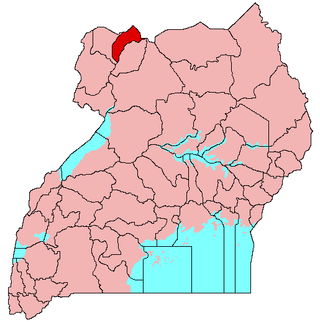
Arua is a city and commercial centre within the Arua District in the Northern Region of Uganda.

A Local Council (LC) is a form of local elected government within the districts of Uganda.

Busia is a county in the former Western Province of Kenya. It borders Kakamega County to the east, Bungoma County to the north, Lake Victoria and Siaya County to the south and Uganda's Busia District to the west. The county population was 893,861, as of 2019. It spans about 1,700 square kilometers, making it one of the smallest counties in Kenya. Busia is inhabited by the Luhya tribe and the Teso of Kenya, and small groups of the Luo. The Luhya communities include the Abakhayo, Marachi, Samia and Abanyala communities.

West Nile sub-region, previously known as West Nile Province and West Nile District, is a sub-region in north-western Uganda, in the Northern Region of Uganda.
Hoima is a city in the Western Region of Uganda. It is the main municipal, administrative, and commercial center of Hoima District. It is also the location of the palace of the Omukama of Bunyoro.

Kibaale is a town in the Western Region of Uganda. It is the main municipal, administrative, and commercial center of Kibaale District, and the district headquarters are located there.

Amuria District is a district in the Eastern Region of Uganda. The town of Amuria serves as the district headquarters.

Bukwo District is a district in the Eastern Region of Uganda. The town of Bukwo is its main political, administrative, and commercial center and the site of the district headquarters.
Amolatar District is a district in Northern Uganda. Like many other Ugandan districts, it is named after its main municipal and administrative centre, Amolatar Town.

Buliisa District is a district in Western Uganda. As with most Ugandan districts, Buliisa District is named after its "main town" Buliisa, where the district headquarters are located. Bugungu has 6 sub counties: Kigwera, Ngwedo, Buliisa, Butiaba, Kihungya, and Biiso. It also contain 3 town councils: Buliisa, Butiaba and Biiso.

Abim District is a district in Northern Uganda. It is named after its 'chief town', Abim, where the district headquarters are located.

Kaabong is a town in the Northern Region of Uganda. It is the chief municipal, administrative and commercial center of the eponymous Kaabong District, and the district headquarters are located in the town.
Bududa is a town in the Eastern Region of Uganda. It is the main municipal, administrative, and commercial center of Bududa District.
Bunyangabu District is a district in the Western Region of Uganda. The town of Kibiito is the political and administrative center of the district. However, the town of Rwimi, is the largest and main commercial center of Bunyangabu.
The Gimara tribe are a group of people living in Northern Uganda in Moyo District. Gimara is a sub-county in Uganda with 2 parishes and 17 villages. Considered as a minority tribe in Uganda, the government added Gimara tribe to be recognized in Uganda's constitution of 1995 as independent tribes.