Lira District

Last updated
Lira District
Lira District in Uganda.svg
District location in Uganda
Coordinates: 02°20′N33°06′E / 2.333°N 33.100°E / 2.333; 33.100
CountryFlag of Uganda.svg  Uganda
Region Northern Uganda
Sub-region Lango sub-region
Capital Lira
Area
  Total1,368.9 km2 (528.5 sq mi)
  Land1,328.9 km2 (513.1 sq mi)
  Water40 km2 (20 sq mi)
Elevation
1,080 m (3,540 ft)
Population
 (2012 Estimate)
  Total403,100
  Density303.3/km2 (786/sq mi)
Time zone UTC+3 (EAT)
Website www.lira.go.ug
A dilapidated elevation sign at Lira, Uganda, September 2010. Uganda railways assessment 2010 - Flickr - US Army Africa.jpg
A dilapidated elevation sign at Lira, Uganda, September 2010.

Lira District is a district in Northern Uganda. Like many other Ugandan districts, it is named after its 'chief town', Lira.

Contents

Location

Cycling along the train tracks. A lady rides a bicycle with a passenger along the train tracks in Lira town, Uganda.jpg
Cycling along the train tracks.

Lira District is bordered by Pader District to the north, Otuke District to the northeast, Alebtong District to the east, Dokolo District to the southeast, Apac District to the southwest and Kole District to the west. [1] The main municipal, administrative and commercial center in the district, Lira, is located 110 kilometres (68 mi), by road, southeast of Gulu, the largest city in Northern Uganda. [2] The coordinates of the district are: 2° 16' 26" N / 32° 57' 11" E. [3]

Overview

Until 2005, the district comprised six counties; Erute, Dokolo, Kyoga, Otuke, Moroto and Lira Municipality. These were further subdivided into 28 sub-counties. Of the 28 sub-counties, four are Municipal Divisions. There are a total of 192 parishes with 2,247 villages. With Dokolo becoming a district in 2005, Alebtong and Otuke in 2010, Lira District now consists of three counties: Erute North County, Erute South County and Lira Municipality.

Conflict and displacement

Long untouched by the Lord's Resistance Army insurgency that ravaged Kitgum and Pader Districts to the north, the increased violence of 2002 resulted in massive population displacement within the district of Lira. However, as of June 2009, the security situation in the district was relatively peaceful. In 2006 and 2007, Lira District experienced a massive return of Internally Displaced Persons. Over 310,000 of the estimated 350,000 left camps to return to their home villages in a period of 14 months.

Lango sub-region

Lira District is part of Lango sub-region, which consists of the following districts: Alebtong, Amolatar, Apac, Dokolo, Lira, Kole, Otuke and Oyam. The sub-region is coterminous with the now defunct Lango District. Lango sub-region was home to an estimated 1.5 million Langi in 2002, according to the national census conducted at that time.[ citation needed ]

Population

The 1991 census estimated the population in the district at about 191,500. The 2002 national census put the district population at about 290,600, with an annual population growth rate of 3.4%. [4] In 2012, the population of Lira District was estimated at about 403,100. [5] The majority of the population are ethnic Lango and the predominant language spoken is Lango. [6]

Economic activity

Lira District has a diversified economy including:

  1. Grain Milling
  2. Wholesale and retail sales
  3. Leisure industry
  4. Brick making
  5. Pottery
  6. Roof tile making
  7. Carpentry
  8. Logging
  9. Construction
  10. Fishing
  11. Embroidery
  12. Crop processing & marketing
  13. Metal repairs & fabrication
  14. Printing services
  15. Bookshop business
  16. Boda-boda business
  17. Pharmaceutical sales

See also

Related Research Articles

<span class="mw-page-title-main">Lango people</span> Ugandan ethnic group

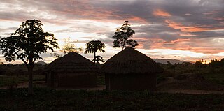
The Lango are a Nilotic ethnic group. They live in north-central Uganda, in a region that covers the area formerly known as the Lango District until 1974, when it was split into the districts of Apac and Lira, and subsequently into several additional districts. The current Lango Region now includes the districts of Amolatar, Alebtong, Apac, Dokolo, Kole, Lira, Oyam, Otuke, and Kwania. The total population of Lango District is currently about 2,884,000.

<span class="mw-page-title-main">Pader District</span> District in Northern Uganda, Uganda

Pader District is a district in Northern Uganda. It is named after Pader, the chief municipal, administrative and commercial town in the district, where the district headquarters are located.

<span class="mw-page-title-main">Apac District</span> District in Northern Region, Uganda

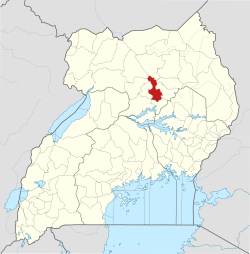
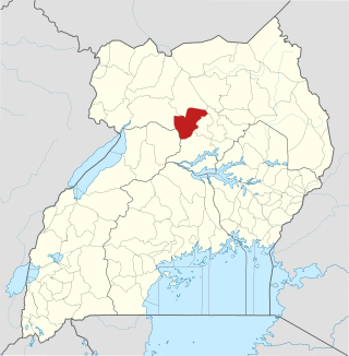
Apac District is a district in the Northern Region of Uganda. The Town of Apac hosts the district headquarters.

<span class="mw-page-title-main">Lira, Uganda</span> Place in Northern Region of Uganda, Uganda

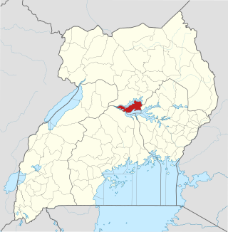
Lira is a city in the Northern Region of Uganda. It is the main municipal, administrative, and commercial centre of Lira District.

<span class="mw-page-title-main">Apac</span> Ugandan town

Apac is a town in Apac District in the Northern Region of Uganda. It is the 'chief town' of the district and the district headquarters are located there. The district is named after the town.

<span class="mw-page-title-main">Lango sub-region</span>

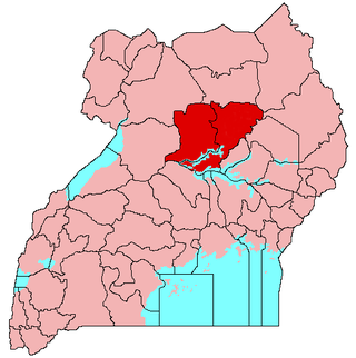
Lango sub-region is a region in Uganda covering an area of 15,570.7km consisting of the districts of:

Aboke is a town in the Kole District of the Northern Region of Uganda. It was the location of the Aboke abductions in October 1996.

<span class="mw-page-title-main">Amolatar District</span> District in Northern Uganda, Uganda

Amolatar District is a district in Northern Uganda. Like many other Ugandan districts, it is named after its main municipal and administrative centre, Amolatar Town.

Lira Regional Referral Hospital, commonly known as Lira Hospital, is a hospital in Lira in the Northern Region of Uganda. It is the referral hospital for the districts of Amolatar, Apac, Dokolo, Lira, Kole, and Oyam.

Pader is a town in Pader District in the Northern Region of Uganda. The town is administered by the Pader Town Council, an urban local government. It is the largest metropolitan area in the district and the site of the district headquarters.

<span class="mw-page-title-main">Dokolo District</span> District in Northern Region, Uganda

Dokolo District is a district in the Northern Region of Uganda. The town of Dokolo is its main municipal, administrative, and commercial centre.

Dokolo is a town in the Northern Region of Uganda. It is the main municipal, administrative, and commercial centre of Dokolo District.

<span class="mw-page-title-main">Oyam District</span> District in Northern Uganda, Uganda

Oyam District is a district in Northern Uganda. Like most Ugandan districts, it is named after its 'chief town', Oyam, where the district headquarters are located.

<span class="mw-page-title-main">Agago District</span> District in Northern Uganda, Uganda

The Agago District is a Ugandan district located in the Northen Region of Uganda.

<span class="mw-page-title-main">Otuke District</span> District in Uganda

Otuke District is a district in Northern Uganda. Like many other Ugandan districts, Otuke district is named after its 'chief town', Otuke, where the district headquarters are located.

<span class="mw-page-title-main">Kole District</span> District in Northern Uganda, Uganda

Kole District is a district in Northern Uganda. Like most other Ugandan districts, it is named after its 'chief town', Kole, where the district headquarters are located.

<span class="mw-page-title-main">Alebtong District</span> District in Northern Region of Uganda, Uganda

Alebtong District is a district in the Northern Region of Uganda. The town of Alebtong serves as the district headquarters.

Alebtong, is a town in the Northern Region of Uganda. It is the chief municipal, administrative, and commercial centre of Alebtong District. The district is named after the town.

The Soroti–Dokolo–Lira Road is a road in Uganda, connecting the towns of Soroti in Soroti District, Dokolo in Dokolo District, and Lira in Lira District.

References

  1. Uganda District Map
  2. "Map Showing Gulu And Lira With Distance Marker". Globefeed.com. Retrieved 8 May 2014.
  3. "Map - Lira District - MAP[N]ALL.COM". mapnall.com. Retrieved 2022-02-14.
  4. "Lira District Population Sub-Sector". Lira District Administration. Retrieved 8 May 2014.
  5. "Estimated Population of Lira District In 1991, 2002 & 2012". Citypopulatin.de. Retrieved 8 May 2014.
  6. "Uganda -- Ethnic Groups". www.africa.upenn.edu. Retrieved 2022-02-14.