Kikuube District

Last updated

Kikuube District
Water Sampling in Buhuka Kikuube District.jpg
Water sampling in Kikuube District
Coordinates: 01°13′N31°08′E / 1.217°N 31.133°E / 1.217; 31.133
CountryFlag of Uganda.svg  Uganda
Region Western Uganda
Sub-region Bunyoro sub-region
Area
  Total2,097 km2 (810 sq mi)
Population
 (1 July 2020)
  Total358,700 Estimate
  Density171.1/km2 (443/sq mi)
Time zone UTC+3 (EAT)

Kikuube District is a district in the Western Region of Uganda. It is named after its main municipal centre, Kikuube. [1]

Contents

Location

Kikuube District is bordered by Hoima District to the north and east, Kakumiro District to the southeast, Kibaale District and Kagadi District to the south, Ntoroko District to the southwest and Lake Albert and the Democratic Republic of the Congo to the west. The district headquarters are located at Kikuube, about 25 kilometres (16 mi), southwest of the city of Hoima, the largest urban centre in the Bunyoro sub-region. [2] Kikuube is located about 215 kilometres (134 mi), by road, northwest of Kampala, Uganda's capital and largest city. [3]

Overview

Up until 30 June 2018, Kikuube District was part of Hoima District. On 1 July 2018, the southwestern portion of Hoima District was hived off to create Kikuube District. [4] As of October 2020, Bunyoro sub-region comprises the districts of 1. Hoima 2. Buliisa 3. Masindi 4. Kiryandongo 5. Kakumiro 6. Kibaale, 7. Kagadi and 8. the district of Kikuube. The establishment of Kikuube District led to the creation of an estimated 700 new jobs. [5]  

Population

The national population census and household survey held on 27 August 2014 enumerated 267,455 people in the district. In 2020, the Uganda Bureau of Statistics (UBOS), estimated the mid-year population of the district at approximately 358,700 people, with about 184,200 (51.4 percent) males and 174,500 (48.6 percent) females. The district population grew at an estimated 5.15 percent average annual rate, between 2014 and 2020. Approximately 89.5 percent of the district population is rural and 10.5 percent of the population is urban. [6]

Economic activities

In 2006, the Kingfisher oil field was discovered in Kikuube District. Oil production, processing facilities will be located on the Buhuka Flats at the shores of Lake Albert with the start of the East African Crude Oil Pipeline. [7] Kikuube district in common with Hoima District, from which it was created, has considerable undeveloped oil and natural gas deposits. [8]

With the establishment of Hoima Sugar Limited, many smallholder farmers have taken up growling sugarcane. As of September 2020, in excess of 3,500 smallholder farmers, had signed out-grower contracts with the sugar factory and collectively had over 8,000 hectares (20,000 acres) under sugarcane cultivation. [8]

See also

Related Research Articles

<span class="mw-page-title-main">Hoima District</span> District in Western Uganda, Uganda

Hoima District is a district in Western Uganda. Like most other Ugandan districts, it is named after its main municipal centre, Hoima.

<span class="mw-page-title-main">Kibaale District</span> District in Western Region, Uganda

Kibaale District, is a district in the Western Region of Uganda. The district headquarters are in the town of Kibaale.

Hoima is a city in the Western Region of Uganda. It is the main municipal, administrative, and commercial center of Hoima District. It is also the location of the palace of the Omukama of Bunyoro.

<span class="mw-page-title-main">Kibaale</span> Place in Western Uganda, Uganda

Kibaale is a town in the Western Region of Uganda. It is the main municipal, administrative, and commercial center of Kibaale District, and the district headquarters are located there.

<span class="mw-page-title-main">Nkusi River</span> River in Uganda

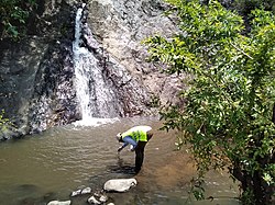
The Nkusi River is in the Bunyoro sub-region, in the Western Region of Uganda.

<span class="mw-page-title-main">Buliisa District</span> Ugandan administrative district

Buliisa District is a district in Western Uganda. As with most Ugandan districts, Buliisa District is named after its "main town" Buliisa, where the district headquarters are located. Bugungu has 6 sub counties Kigwera, Ngwedo, Buliisa, Butiaba, Kihungya, and Biiso and 3 town councils.

Buliisa, also Bulisa, is a town in the Western Region of Uganda. It is the site of the headquarters of the Buliisa District. Neighborhoods within Buliisa Municipality include Wanseko and Kasenyi.

Kagadi is a town in the Western Region of Uganda. It is the commercial and administrative headquarters of Kagadi District.

Hoima Regional Referral Hospital, commonly known as Hoima Hospital, is a hospital in the city of Hoima in Hoima District in the Western Region of Uganda. It is the referral hospital for the districts of Bulisa, Hoima, Kibaale, Kiryandongo, Kagadi, Kakumiro, Kikuube, and Masindi.

Butiaba, is a town in the Western Region of Uganda. It is a fishing town and landing site on the shores of Lake Albert, in Uganda.

<span class="mw-page-title-main">Bunyoro sub-region</span>

Bunyoro sub-region is a region in Western Uganda that consists of the following districts:

The Uganda Oil Refinery is a planned crude oil refinery in Kabaale village, on the Eastern shore of Lake Albert along the Hoima–Kaiso–Tonya Road, Buseruka Sub-county, Hoima District, Western Region, Uganda, near the international border with the Democratic Republic of the Congo. After 5 years of negotiations the Albertine Graben Refinery Consortium (AGRC) formed in 2018 and agreed to design and build the refinery.

Kabwoya is a village in the Kikuube District of the Western Region of Uganda.

Mubende–Kakumiro–Kibaale–Kagadi Road is a road in Uganda's Central Region and Western Region, connecting the towns of Mubende in Mubende District to Kakumiro, Kibaale and Kagadi in Kibaale District.

Kakumiro is a town in the Western Region of Uganda. It is the main municipal, administrative, and commercial center of Kakumiro District, and the district headquarters are located there.

Kakumiro District is a district in the Western Region of Uganda.

Kagadi District is a district in the Western Region of Uganda.

Nkusi Hydroelectric Power Station, also referred to as Nkusi Power Station, is a 9.6 MW (12,900 hp) hydroelectric power station in the Western Region of Uganda.

Kasenyi is a village in Ngedwo sub county, Buliisa District, in the Western Region of Uganda. It is the location of a "central processing facility" (CPF) of Uganda's oil fields in the Albertine Graben.

Kikuube is a town in the Western Region of Uganda. It is the main municipal, administrative, and commercial center of Kikuube District and the site of the district headquarters.

References

  1. Robert Atuhairwe (1 April 2018). "Sh15.3b Budget for proposed Kikuube district passed". New Vision . Kampala. Retrieved 6 October 2020.
  2. Google (6 October 2020). "Road Distance Between Hoima And Kikuube, Western Uganda" (Map). Google Maps . Google. Retrieved 6 October 2020.
  3. Google (6 October 2020). "Road Distance Between Kampala And Kikuube" (Map). Google Maps . Google. Retrieved 6 October 2020.
  4. George Okello (4 August 2018). "NRM releases roadmap for primaries in New districts". Kampala: PML Daily. Retrieved 6 October 2020.
  5. Edward Ssekika (16 May 2010). "Hoima split to create 700 jobs". The Observer (Uganda) . Kampala. Retrieved 6 October 2020.
  6. Uganda Bureau of Statistics (12 June 2020). "The population development of Kikuube District as well as related information and services". Citypopulation.de. Retrieved 6 October 2020.
  7. "Kingfisher Oil Field Development, Lake Albert Rift Basin, Uganda" . Retrieved 8 March 2023.
  8. 1 2 Moses Kyeyune (26 September 2020). "Kikuube turns to sugarcane growing as they wait for oil". Daily Monitor . Kampala. Retrieved 6 October 2020.