
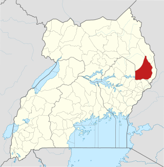
Mbale District is a district in Eastern Uganda. It is named after the largest city in the district, Mbale, which also serves as the main administrative and commercial center in the sub-region.
Nakapiripirit District is a district in Northern Uganda. Like many Ugandan districts, it is named after its 'chief town', Nakapiripirit, where the district headquarters are located.

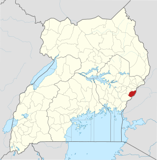
Kapchorwa District is a district in the Eastern Region of Uganda. The town of Kapchorwa is the district's main municipal, administrative, and commercial center, and is the site of the district headquarters. It is also the home district of Stephen Kiprotich, the men's marathon gold medalist at the 2012 Summer Olympics, and Joshua Cheptegei, the men's 5,000 m gold medalist at the 2021 Summer Olympics in Tokyo.
Pallisa District is a district in Eastern Uganda which was carved out of Tororo district in 1991. Like most other Ugandan districts, it is named after its main town, Pallisa, where the district headquarters are located.

Sironko District is a district in the Eastern Region of Uganda. The district was created in 2000 and had previously been part of Mbale District. Sironko is the main commercial town in the district.

Mbale is a city in the Eastern Region of Uganda. It is the main municipal, administrative, and commercial center of Mbale District and the surrounding sub-region.

Budaka District is a district in the Eastern Region of Uganda. The town of Budaka serves as the district headquarters.
The Sebei are a Southern Nilotic ethnic group inhabiting western Kenya, eastern Uganda, Tanzania, Ethiopia, Sudan and Democratic Republic of the Congo. They speak Kupsabiny, a Kalenjin language. The Sapiiny occupy three districts, namely Bukwo, Kween and Kapchorwa in Uganda, Transnzoia county, Bungoma county and West Pokot county in Kenya
Kapchorwa is a town in the Eastern Region of Uganda. It is the main municipal, commercial, and administrative center of Kapchorwa District. Initially, the town of Kapchorwa was known as the Sebei Region.
Bukwo is a town in Eastern Uganda. It is the main municipal, administrative and commercial center of Bukwo District and the headquarters of the district are located there. The district is named after the town.

Bukwo District is a district in the Eastern Region of Uganda. The town of Bukwo is its main political, administrative, and commercial center and the site of the district headquarters.

Butaleja District is a district in Eastern Uganda. It is named after its main town, Butaleja, where the district headquarters are located.
Manafwa District is a district in the Eastern Region of Uganda. Manafwa is the district headquarters.
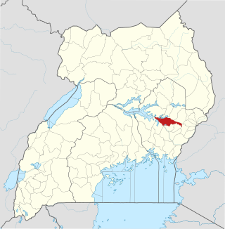
Binyiny is a town in Eastern Uganda. It is the largest town in Kween District and the headquarters of the district are located in the town. Kween District is one of the 23 new Ugandan districts, created in 2010. Prior to July 2010, the district was part of Kapchorwa District.

Bulambuli District is a district in Eastern Uganda. The district is named after 'chief town', Bulambuli, where the district headquarters are located.

Kibuku District is a district in Eastern Uganda. It is named after its 'chief town', Kibuku, where the district headquarters are located.

Amudat District is a district in Northern Uganda. Like most Ugandan districts, it is named after its 'chief town', Amudat, where the district headquarters are located.
The Kapchorwa–Suam Road, is a rural road in the Eastern Region of Uganda. The road links Kapchorwa, the district capital of Kapchorwa District to Suam, at the international border with Kenya.
Kapchorwa General Hospital, also Kapchorwa Hospital, is a public hospital in the Eastern Region of Uganda.

Lawrence Cherop Mangusho is a Ugandan public administrator, farmer and politician. He is the elected member of parliament for Kween County, Kween District, and a representative for National Resistance Movement (NRM), the ruling political party in Uganda. He is a member the NRM Parliamentary Caucus and serves on the Committee on Physical Infrastructure and the Committee on Government Assurances in the 10th Parliament of Uganda.

