Moyo District

Last updated
Moyo District
Moyo District in Uganda.svg
District location in Uganda
Coordinates: 03°39′N31°43′E / 3.650°N 31.717°E / 3.650; 31.717
CountryFlag of Uganda.svg  Uganda
Region Northern Uganda
Sub-region West Nile sub-region
Capital Moyo
Area
  Total1,800.8 km2 (695.3 sq mi)
Population
 (2014 Estimate)
  Total194,734
  Density229.1/km2 (593/sq mi)
Time zone UTC+3 (EAT)
Website www.moyo.go.ug

Moyo District is a district in Northern Region of Uganda. Like many other Ugandan districts, it is named after its "chief town", Moyo, where the district headquarters are located.

Contents

Location

Moyo District is located in Uganda's extreme north, in the West Nile sub-region. The district is bordered by South Sudan to the north and east, Adjumani District to the south, across the waters of the White Nile, and Yumbe District to the west. The South Sudanese state of Central Equatoria and Eastern Equatoria form the northern border, and a road runs from Moyo to the town of Kajo Keji in Central Equatoria. The district headquarters at Moyo, are located approximately 158 kilometres (98 mi), by road, northeast of Arua, the largest city in the sub-region. [1] This location lies approximately 476 kilometres (296 mi), by road, northwest of Kampala, Uganda's capital and largest city. [2] The coordinates of the district are:03 39N, 31 43E (Latitude:3.6500; Longitude:31.7190).

Overview

In recent years the district has stagnated in isolation as the Second Sudanese Civil War raged to the north and the insurgency of the Lord's Resistance Army made the direct road south to the national capital of Kampala perilous. The district has hosted a large number of South Sudanese refugees who fled the fighting in their country. The 2005 Sudanese peace agreement and reduced activities of the LRA have raised hopes that Moyo District will again become the prosperous transit area for cross-border trade that it once was.

Population

The 1991 census estimated the population of the district at about 79,400. The population of Moyo District according to the 2002 national census was about 194,800, of whom 48.8% were females and 51.2% were males. In the first decade of the 2000s, Moyo District experienced rapid population growth, primarily from refugees fleeing war in South Sudan. It is estimated that the annual population growth rate in the district has averaged 7.9%, between 2002 and 2012. It is estimated that the population of the district in 2012, was approximately 412,500. [3]

Economic activities

Like in most other Ugandan districts, agriculture forms the backbone of the district economy. Over 90% of the district population are involved in agricultural activities, with 86.6% of the population involved in some form of subsistence production. Most agricultural production is for household consumption. Some of the agricultural produce is sold, particularly maize, cassava and simsim. The main crops grown in the district include:

The Nile River is the main source of fish within the district. Some cattle, goats and chicken are kept, mostly on a subsistence level. Bee keeping, for honey production, is gaining popularity in the district. [4]

See also

Related Research Articles

<span class="mw-page-title-main">Adjumani District</span> District in Northern Region, Uganda

Adjumani District is a district in Northern Uganda. Like most other Ugandan districts, it is named after its 'chief town', Adjumani, where the district headquarters are located.

<span class="mw-page-title-main">Apac District</span> District in Northern Region, Uganda

Apac District is a district in the Northern Region of Uganda. The Town of Apac hosts the district headquarters.

<span class="mw-page-title-main">Arua District</span> District in Northern Uganda, Uganda

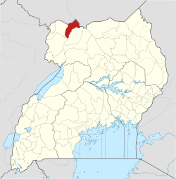
Arua District is a district in the Northern Region of Uganda. Like many other Ugandan districts, it shares its name with its administrative center of Arua. The name Arua is said to be derived from the Lugbara name for prison (Arujo) and prisoner (Aru), since the white settlers had a detention center at Arua Hill.

<span class="mw-page-title-main">Nebbi District</span> District in Northern Uganda, Uganda

Nebbi District is a district in Northern Uganda. It is named after its main municipal, commercial and administrative centre, Nebbi, the location of the district headquarters.

<span class="mw-page-title-main">Yumbe District</span> District in Northern Uganda, Uganda

Yumbe District is a district in Northern Region, Uganda. Like most other Ugandan districts, it is named after its 'chief town', Yumbe, where the district headquarters are located.

<span class="mw-page-title-main">Tororo District</span> District in Uganda

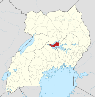
Tororo District is a district in the Eastern Region of Uganda. The town of Tororo serves as the district headquarters.

<span class="mw-page-title-main">Masindi District</span> District in Western Uganda, Uganda

Masindi District is a district in Western Uganda. Like many other Ugandan districts, it is named after its 'chief town' of Masindi, the location of the district headquarters.

<span class="mw-page-title-main">Arua</span> Place in Northern Region, Uganda

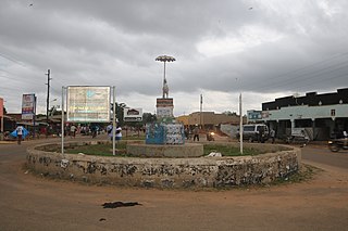
Arua is a city and commercial centre within the Arua District in the Northern Region of Uganda.

<span class="mw-page-title-main">West Nile sub-region</span>

West Nile sub-region, previously known as West Nile Province and West Nile District, is a sub-region in north-western Uganda, in the Northern Region of Uganda.

<span class="mw-page-title-main">Adjumani</span> Ugandan town

Adjumani is a town in the Northern Region of Uganda. It is the main municipal, administrative, and commercial centre of Adjumani District. The district is named after the town.

Moyo, is the main municipal, administrative, and commercial center of Moyo District in the Northern Region of Uganda. The district headquarters are located here.

Koboko is a town in Northern Region of Uganda. It is the main municipal, administrative, and commercial centre of Koboko District. Koboko is also the hometown of former dictator Idi Amin who ruled Uganda from 1971 to 1979.

<span class="mw-page-title-main">Amolatar District</span> District in Northern Uganda, Uganda

Amolatar District is a district in Northern Uganda. Like many other Ugandan districts, it is named after its main municipal and administrative centre, Amolatar Town.

<span class="mw-page-title-main">Magwi County</span> County in Eastern Equatoria, South Sudan

Magwi County, also Magwe County, is a county in Eastern Equatoria, South Sudan.

<span class="mw-page-title-main">Amuru District</span> District in Northern Uganda, Uganda

Amuru District is a district in Northern Uganda. Like most Ugandan districts, it is named after its 'chief town', Amuru, where the district headquarters are located.

<span class="mw-page-title-main">Abim District</span> District in Uganda

Abim District is a district in Northern Uganda. It is named after its 'chief town', Abim, where the district headquarters are located.

<span class="mw-page-title-main">Maracha District</span> District in Northern Region, Uganda

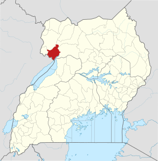
Maracha District is a district in the West Nile sub-region, in the Northern Region of Uganda. It was formed in 2006 from Arua District.

<span class="mw-page-title-main">Morobo County</span> County in Central Equatoria, South Sudan

Morobo is one of the six counties in Central Equatoria state, South Sudan. Morobo County borders Uganda and Congo. The county is mainly occupied by Kakwa speaking people, Keliko and Lugbara. The people in Morobo are farmers doing local farming mostly for food and some for sale. Morobo is part of the green belt and also acts as a breadbasket for Yei and Juba.

Afoji is a town in Moyo District, in the Northern Region of Uganda.

The Koboko–Yumbe–Moyo Road is a road in the Northern Region of Uganda, connecting the towns of Koboko, Yumbe, and Moyo.

References

  1. Google (13 October 2020). "Distance Between Arua City And Moyo Town" (Map). Google Maps . Google. Retrieved 13 October 2020.
  2. Google (13 October 2020). "Road Distance From Kampala To Moyo" (Map). Google Maps . Google. Retrieved 13 October 2020.
  3. "Estimated Population of Moyo District In 1991, 2002 & 2012". Citypopulation.de. Retrieved 23 May 2014.
  4. "Profile of Moyo District". Uganda Travel Guide. Retrieved 23 May 2014.