In 1834–1835, Little River became part of Robertson's Colony, made up of settlers from Nashville, Tennessee, led by Sterling C. Robertson; they were the families of Captain Goldsby Childers, Robert Davison, John Fulcher, Moses Griffin, John Needham, Michael Reed and his son William Whitaker Reed, William Taylor, and Judge Orville T. Tyler.[5] This area became known as the Tennessee Valley. Soon after (1836) the settlements were deserted during the Runaway Scrape,[6] reoccupied, deserted again after the Elmwood Creek Blood Scrape, and reoccupied. Texas Ranger George Erath established a fort on Little River.[7]
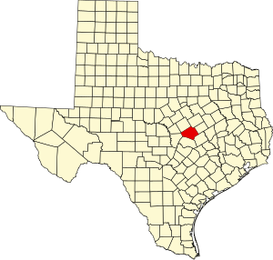
In 1850, Bell County was organized and named for Texas Governor Peter Hansborough Bell. The population then was 600 whites and 60 black slaves.[5] Belton[9] was designated as the county seat in 1851.
The last serious Indian raid in the area occurred in 1859.[5] Bell County assumed its present boundaries[5] with the 1860 resurvey of the line between Bell and Milam Counties.
In 1861, the county voted for secession from the Union.[5] Residents were divided, as many yeomen farmers did not support the war. From 1862 to 1865, Union sympathizers and Confederate deserters holed up in "Camp Safety".[5] Following the war, new social movements developed. In 1867, the Belton Women's Commonwealth, the first women's movement in Central Texas, was formed by Martha McWhirter. The group provided shelter to women in abusive relationships.[5]
During the early years of the Reconstruction era (1865–1877), so much violence occurred in the county that the government stationed federal troops in Belton. Some racist whites attacked blacks and their white supporters. Corruption, lawlessness, and racial divides were severe. As in many areas, a local version of white paramilitaryinsurgents developed who were similar to the Ku Klux Klan; they worked to suppress black and Republican voting.[5]
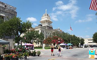
The coming of railroads in the late 19th century stimulated growth across the state. In 1881, the Gulf, Colorado and Santa Fe Railway, the first railroad to be built in Bell County, established Temple as its headquarters.[5] Reflecting growth in the county, in 1884, the Bell County Courthouse was built. It is still used. The ambitious Renaissance Revival design was by architect Jasper N. Preston and Sons.[10] As another improvement, in 1905, the Belton and Temple Interurban electric railway was completed, providing service between the cities.[5]
During the 1920s, the Ku Klux Klan underwent a revival in Bell County. In many areas, it was concentrated on nativist issues, opposing Catholic and Jewish immigration from eastern and southern Europe. After a scandal involving the leader of the KKK, the group's influence declined markedly by the end of the decade.[5]
In 1925, Miriam A. Ferguson, a native of the county, was inaugurated as the first woman governor of the state.[11] She won re-election in 1932 for a nonconsecutive second term.[11]
The county and state supported founding Temple Junior College in 1926. The entry of the United States in World War II stimulated war spending across the country. In 1942, Fort Hood was opened as a military training base. It drew recruits from across the country.[5]
The postwar period was one of suburbanization in many areas. In 1954, the U.S. Supreme Court ruled in Brown v. Board of Education that racial segregation in public schools, supported by all the taxpayers, was unconstitutional. Two years later, the Killeen school board voted to integrate the local high school. .[12]
Since the late 20th century, new retail development has taken the form of large malls. In 1976, Temple Mall opened.[13] By 1980, Killeen became the most populous city in Bell County.[12] The following year, the Killeen Mall opened, adding to retail choices in the area.[14] In another type of development, the Bell County Expo Center opened in 1987.
Since the late 20th century, the county has been the site of several mass shootings. On October 16, 1991, in the Luby's shooting, George Hennard murdered 23 people and wounded 27 others before killing himself. It was the deadliest mass shooting in the United States at the time.[15] In the 2009 Fort Hood shooting, Army majorNidal Hasan murdered 13 people and wounded 30 others before being paralyzed in return fire.[16] In the 2014 Fort Hood shootings, Army Specialist Ivan Lopez murdered three people and wounded 16 others.[17]
Geography
According to the U.S. Census Bureau, the county has a total area of 1,088 square miles (2,820km2), of which 1,051 square miles (2,720km2) are land and 37 square miles (96km2) (3.4%) are covered by water.[18]
Note: the US Census treats Hispanic/Latino as an ethnic category. This table excludes Latinos from the racial categories and assigns them to a separate category. Hispanics/Latinos can be of any race.
As of the census[24] of 2010, 310,235 people, 114,035 households, and 80,449 families resided in the county. The population density was 295.2 peopleper square mile (114.0 people/km2). The 125,470 housing units averaged 88 unitsper square mile (34/km2). The racial makeup of the county was 61.4% White, 21.5% Black, 0.8% Native American, 2.8% Asian, 0.8% Pacific Islander, and 5.0% from two or more races. About 21.6% of the population was Hispanic or Latino of any race; 14.9% were of Mexican, 3.6% were of Puerto Rican, 0.2% Cuban, and 0.2% were of Dominican descent.
Of the 85,507 households, 40.10% had children under the age of 18 living with them, 56.60% were married couples living together, 12.30% had a female householder with no husband present, and 27.50% were not families. About 22.30% of all households were made up of individuals, and 6.50% had someone living alone who was 65 years of age or older. The average household size was 2.68 and the average family size was 3.14. As of the 2010 census, about 3.6 same-sex couples per 1,000 households were in the county.[25]
In the county, the population was distributed as 28.90% under the age of 18, 13.40% from 18 to 24, 31.90% from 25 to 44, 17.00% from 45 to 64, and 8.80% who were 65 years of age or older. The median age was 29 years. For every 100 females, there were 100.80 males. For every 100 females age 18 and over, there were 99.30 males.
The median income for a household in the county was $36,872, and for a family was $41,455. Males had a median income of $28,031 versus $22,364 for females. The per capita income for the county was $17,219. About 9.70% of families and 12.10% of the population were below the poverty line, including 16.30% of those under age 18 and 9.80% of those age 65 or over.
Education
Bell County is served by several school districts:
Politically, Bell County tends to support Republican Party candidates for office. It has voted for the Republican presidential nominee every cycle beginning with Ronald Reagan in 1980. The county has been trending Democratic, similar to the patterns of the state as a whole.
Democratic strength in the county is concentrated in the city of Killeen, which gave Joe Biden 63.4% of the vote in the 2020 election. The remainder of the county, particularly the cities of Belton and Temple, is much more strongly Republican.[28]
Lampasas County is a county located on the Edwards Plateau in the U.S. state of Texas. As of the 2020 census, its population was 21,627. Its county seat is Lampasas. The county is named for the Lampasas River.
Hamilton County is a county located on the Edwards Plateau in the U.S. state of Texas. As of the 2020 census, its population was 8,222. The county seat is Hamilton. The county was created in 1858. It is named for James Hamilton Jr., a former governor of South Carolina who gave financial aid to the Republic of Texas.
Coryell County is a county located on the Edwards Plateau in the U.S. state of Texas. As of the 2020 census, its population was 83,093. The county seat is Gatesville. The county is named for James Coryell, a frontiersman and Texas Ranger who was killed by Caddo Indians.
Belton is a city in the U.S. state of Texas. Belton is the county seat of Bell County and is the fifth largest city in the Killeen-Temple metropolitan area. In 2020, the population of Belton was 23,054, and the metro region had a population of 450,051 according to US Census estimates.
Harker Heights is a city in Bell County, Texas, United States. As of the 2020 census, 33,097 people resided in the city, up from a population of 17,308 in 2000. This makes Harker Heights the third-largest city in Bell County, after Killeen and Temple. Incorporated in 1960, the city derives its name from one of the two original landowners and founder, Harley Kern. Harker Heights is part of the Killeen–Temple–Fort Hood metropolitan area. People usually refer to the town as just "Heights".
Holland is a city in Bell County, Texas, United States. The population was 1,075 at the 2020 census. The center of population of Texas is located in Holland. It is part of the Killeen–Temple–Fort Hood metropolitan statistical area.
Killeen is a city in the U.S. state of Texas, located in Bell County. According to the 2020 census, its population was 153,095, making it the 19th-most populous city in Texas and the largest of the three principal cities of Bell County. It is the principal city of the Killeen–Temple–Fort Cavazos Metropolitan Statistical Area. Killeen is 55 miles (89 km) north of Austin, 125 miles (201 km) southwest of Dallas, and 125 miles (201 km) northeast of San Antonio.
Little River-Academy is a city in Bell County, Texas, United States. The population was 1,992 at the 2020 census. It is part of the Killeen–Temple–Fort Hood Metropolitan Statistical Area.
Morgan's Point Resort is a General Law city in Bell County, Texas, United States. Morgan's Point Resort was incorporated 1970. As of the 2020 census, the population was 4,636. It is part of the Killeen–Temple–Fort Hood Metropolitan Statistical Area.
Nolanville is a city in Bell County, Texas, United States. The population was 5,917 at the 2020 census. It is part of the Killeen–Temple–Fort Hood Metropolitan Statistical Area.
Temple is a city in Bell County, Texas, United States. As of 2020, the city has a population of 82,073 according to the U.S. census, and is one of the two principal cities in Bell County.
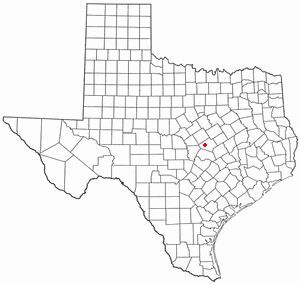
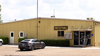
Troy is a city in Bell County, Texas, United States. The population was 2,375 at the 2020 census. It is part of the Killeen–Temple–Fort Hood Metropolitan Statistical Area.
Kempner is a city in Lampasas County, Texas, United States. The population was 1,146 at the 2020 census. It is part of the Killeen–Temple–Fort Hood Metropolitan Statistical Area.
Lampasas is a city in Lampasas County, Texas, United States. Its population was 7,291 at the 2020 census. It is the seat of Lampasas County.
Lometa is a city in Lampasas County, Texas, United States. The population was 856 at the 2010 census. It is part of the Killeen–Temple–Fort Hood metropolitan statistical area.
Bartlett is a city in Bell and Williamson counties in the U.S. state of Texas. The population was 1,633 at the 2020 census.
Copperas Cove is a city located in central Texas at the southern corner of Coryell County with smaller portions in Lampasas and Bell counties. Founded in 1879 as a small ranching and farming community, today the city is the largest in Coryell County, with 36,670 at 2020. The city's economy is closely linked to nearby Fort Cavazos, making it part of the Killeen-Temple-Fort Hood Metropolitan Statistical Area. Locals usually refer to the town as just "Cove".
The Central Texas Council of Governments (CTCOG) is a voluntary association of cities, counties and special districts in Central Texas.
Killeen–Temple is a metropolitan statistical area in Central Texas that covers three counties: Bell, Coryell, and Lampasas. As of the 2020 census, the MSA had a population of 475,367.
Union Grove is an unincorporated community in Bell County, in the U.S. state of Texas. According to the Handbook of Texas, only four people lived in the community in 2000. It is located within the Killeen-Temple-Fort Hood metropolitan area.
References
↑ "Find a County". National Association of Counties. Archived from the original on July 12, 2012. Retrieved June 7, 2011.
↑ Covington, Carolyn Callaway. "Runaway Scrape". Handbook of Texas Online. Texas State Historical Association. Archived from the original on November 12, 2010. Retrieved November 30, 2010.
↑ Cutrer, Thomas W. "George Bernard Erath". Handbook of Texas Online. Texas State Historical Association. Retrieved November 30, 2010.
↑ Brackney, William H (2009). Congregation and Campus: Baptists in Higher Education. Mercer University Press. p.147. ISBN978-0-88146-130-5.
↑ "Belton, Texas". Texas Escapes. Texas Escapes - Blueprints For Travel, LLC. Retrieved November 30, 2010.
↑ "Bell County Courthouse". Texas Escapes. Texas Escapes - Blueprints For Travel, LLC. Retrieved November 30, 2010.
1 2 Huddleston, John. "Miriam Ferguson". Handbook of Texas Online. Texas State Historical Association. Archived from the original on December 21, 2010. Retrieved November 30, 2010.
1 2 3 Leffler, John. "Killeen, Texas". Handbook of Texas Online. Texas State Historical Association. Retrieved November 30, 2010.
↑ "Temple Mall"(PDF). Urban Retail Properties. Archived from the original(PDF) on March 17, 2013. Retrieved December 31, 2011.
↑ "Killeen Mall"(PDF). Jones Lang Lasalle. March 2010. Archived from the original(PDF) on March 4, 2016. Retrieved March 25, 2010.
This page is based on this Wikipedia article Text is available under the CC BY-SA 4.0 license; additional terms may apply. Images, videos and audio are available under their respective licenses.