Chambers County, Texas

Last updated

Chambers County
Chambers county tx courthouse 2014.jpg
The Chambers County Courthouse in Anahuac
Map of Texas highlighting Chambers County.svg
Location within the U.S. state of Texas
Texas in United States.svg
Texas's location within the U.S.
Coordinates: 29°42′N94°41′W / 29.7°N 94.68°W / 29.7; -94.68
CountryFlag of the United States.svg United States
StateFlag of Texas.svg  Texas
Founded1858
Named for Thomas Jefferson Chambers
Seat Anahuac
Largest city Mont Belvieu
Area
  Total871 sq mi (2,260 km2)
  Land597 sq mi (1,550 km2)
  Water274 sq mi (710 km2)  31%
Population
 (2020)
  Total46,571 [1]
  Density78.0/sq mi (30.1/km2)
Time zone UTC−6 (Central)
  Summer (DST) UTC−5 (CDT)
Congressional districts 14th, 36th
Website www.co.chambers.tx.us

Chambers County is a county in the U.S. state of Texas. As of the 2020 census, its population was 46,571. [2] [3] The county seat is Anahuac. [4]

Contents

Chambers County is one of the nine counties that comprise Greater Houston, the HoustonThe WoodlandsSugar Land metropolitan statistical area.

History

Mission Nuestra Señora de la Luz, a Spanish mission in Texas, was established in 1756 near what is now Wallisville. [5]

Chambers County was founded in 1858. It is named for Thomas Jefferson Chambers, [6] a major general in the Texas Revolution.

In 2019, Atlas Air Flight 3591, a cargo flight operating for Amazon Air, crashed in the Trinity Bay, in Chambers County and near Anahuac, while flying from Miami to Houston. All three people on board were killed. [7]

Geography

According to the U.S. Census Bureau, the county has a total area of 871 square miles (2,260 km2), of which 597 square miles (1,550 km2) are land and 274 square miles (710 km2) (31%) are covered by water. [8]

The south and southwestern parts of the county lie in the Galveston Bay Area on the shores of Trinity Bay and East Bay. A small portion of the southeastern area lies on the coast of the Gulf of Mexico.

Adjacent counties

National protected areas

State and local protected areas

Communities

Cities

Census-designated places

Unincorporated communities

Demographics

Historical population
CensusPop.Note
1860 1,508
1870 1,503−0.3%
1880 2,18745.5%
1890 2,2412.5%
1900 3,04635.9%
1910 4,23439.0%
1920 4,162−1.7%
1930 5,71037.2%
1940 7,51131.5%
1950 7,8714.8%
1960 10,37931.9%
1970 12,18717.4%
1980 18,53852.1%
1990 20,0888.4%
2000 26,03129.6%
2010 35,09634.8%
2020 46,57132.7%
2023 (est.)53,87615.7%
U.S. Decennial Census [9]
1850–2010 [10] 2010 [11] 2020 [12]
Chambers County, Texas - Demographic Profile
(NH = Non-Hispanic)
Race / EthnicityPop 2010 [11] Pop 2020 [12] % 2010% 2020
White alone (NH)24,76729,85870.57%64.11%
Black or African American alone (NH)2,8173,1488.03%6.76%
Native American or Alaska Native alone (NH)1341610.38%0.35%
Asian alone (NH)3266220.93%1.34%
Pacific Islander alone (NH)1300.04%0.00%
Some Other Race alone (NH)252150.07%0.46%
Mixed Race/Multi-Racial (NH)3791,6151.08%3.47%
Hispanic or Latino (any race)6,63510,95218.91%23.52%
Total35,09646,571100.00%100.00%

Note: the U.S. Census Bureau treats Hispanic/Latino as an ethnic category. This table excludes Latinos from the racial categories and assigns them to a separate category. Hispanics/Latinos can be of any race.

As of the census of 2000, [13] 26,031 people, 9,139 households, and 7,219 families were residing in the county. The population density was 43 people/sq mi (17 people/km2). The 10,336 housing units averaged 17 units per square mile (6.6/km2). The racial makeup of the county was 81.88% White, 9.77% African American, 0.48% Native American, 0.67% Asian, 6.02% from other races, and 1.18% from two or more races. About 10.79% of the population were Hispanics or Latinos of any race.

Of the 9,139 households, 40.60% had children under the age of 18 living with them, 65.70% were married couples living together, 9.00% had a female householder with no husband present, and 21.00% were not families. About 17.80% of all households were made up of individuals, and 6.70% had someone living alone who was 65 years of age or older. The average household size was 2.82, and the average family size was 3.20.

In the county, the age distribution was 28.90% under 18, 8.20% from 18 to 24, 29.90% from 25 to 44, 24.00% from 45 to 64, and 9.00% who were 65 or older. The median age was 35 years. For every 100 females, there were 100.60 males. For every 100 females age 18 and over, there were 99.80 males.

The median income for a household in the county was $47,964, and for a family was $52,986. Males had a median income of $43,351 versus $25,478 for females. The per capita income for the county was $19,863. About 8.30% of families and 11.00% of the population were below the poverty line, including 13.30% of those under age 18 and 12.60% of those age 65 or over.

Government

Chambers County is governed by a five-member commissioners' court, consisting of the county judge and four county commissioners. The county judge is elected to four-year terms in a countywide election. Commissioners are elected to four-year terms from single-member districts.

Chambers County Commissioners' Court

OfficeNamePolitical partyFirst electedArea(s) represented
 County JudgeJimmy Sylvia Republican 1996Countywide
 Commissioner, Precinct 1Jimmy E. GoreRepublican2016Anahuac, Double Bayou, Hankamer, Oak Island, Seabreeze, Smith Point, Stowell, Wallisville, Winnie
 Commissioner, Precinct 2Mark TiceRepublican2018Beach City, Cove, Turtle Bayou, Wallisville
 Commissioner, Precinct 3Tommy HammondRepublican2006Mont Belvieu, Old River-Winfree
 Commissioner, Precinct 4Ryan DagleyRepublican2018Baytown, Beach City

Elected Officials

OfficeNamePolitical party
 County AttorneyAshley Cain LandRepublican
 County ClerkHeather H. HawthorneRepublican
County Court JudgeCindy S. PriceRepublican
 District AttorneyCheryl Swope LieckRepublican
 District ClerkPatti HenryRepublican
 SheriffBrian HawthorneRepublican
 Tax Assessor-CollectorLaurie G. PaytonRepublican
 TreasurerNicole WhittingtonRepublican
County SurveyorMichael W. Chandler

Constables

OfficeNamePolitical partyArea(s) represented
 Constable, Precinct 1Dennis DugatRepublicanStowell, Winnie
 Constable, Precinct 2John MulryanRepublicanAnahuac, Turtle Bayou, Wallisville
 Constable, Precinct 3Donnie StandleyRepublicanDouble Bayou, Oak Island, Smith Point
 Constable, Precinct 4Ben L. "Butch" BeanRepublicanMont Belvieu, Old River-Winfree
 Constable, Precinct 5Bradley W. MoonRepublicanHankamer, Wallisville
 Constable, Precinct 6Kirk W. RitchRepublicanBaytown, Beach City, Cove

United States Congress

SenatorsNamePolitical partyFirst electedLevel
 Senate Class 2 John Cornyn Republican2002Senior Senator
 Senate Class 1 Ted Cruz Republican2012Junior Senator
RepresentativesNamePolitical PartyFirst ElectedArea(s) Represented
  Texas's 14th District Randy Weber Republican2012A small, unpopulated portion of the county that extends to the Gulf of Mexico, across the Intracoastal Waterway.
  Texas's 36th District Brian Babin Republican2014All populated areas of the county

Texas Legislature

Texas Senate

DistrictSenatorPolitical partyFirst electedArea(s) represented
  4 Brandon Creighton Republican2014Countywide, district also covers portions of Galveston, Harris, Jefferson, and Montgomery Counties

Texas House of Representatives

DistrictRepresentativePolitical partyFirst electedArea(s) represented
 23Terri Leo-WilsonRepublican2022Chambers County, Galveston County (part)

State Board of Education

DistrictMemberPolitical partyFirst electedArea(s) represented
 7Julie PickrenRepublican2022Countywide, district also covers all of Brazoria, Galveston, Hardin, Jasper, Jefferson, Liberty, Newton, Orange, and Tyler Counties and most of Fort Bend County

Courts

Justices of the Peace

OfficeNamePolitical party
 Justice of the Peace, Precinct 1Celia DevillierRepublican
 Justice of the Peace, Precinct 2Michael W. WheatRepublican
 Justice of the Peace, Precinct 4Blake D. SylviaRepublican
 Justice of the Peace, Precinct 5David HatfieldRepublican
 Justice of the Peace, Precinct 6Larry Ray CryerRepublican

District Courts

OfficeNamePolitical partyArea(s) represented
 253rd District CourtChap B. Cain, IIIRepublicanCountywide, district also covers Liberty County
 344th District CourtRandy McDonaldRepublicanCountywide

1st Court of Appeals

NamePolitical partyFirst elected
 Chief JusticeSherry RadackRepublican2004, appointed in 2002
 Place 2Gordon GoodmanDemocrat2018
 Place 3Veronica Rivas-MolloyDemocrat2020
 Place 4April FarrisRepublican2020 (appointed)
 Place 5Amparo GuerraDemocrat2020
 Place 6Sarah Beth LandauDemocrat2018
 Place 7Julie CountissDemocrat2018
 Place 8Richard HightowerDemocrat2018
 Place 9Peter KellyDemocrat2018

14th Court of Appeals

NamePolitical partyFirst elected
 Chief JusticeTracy E. ChristopherRepublican2020
 Place 2Kevin JewellRepublican2016
 Place 3Jerry ZimmererDemocrat2018
 Place 4Charles A. SpainDemocrat2018
 Place 5Frances BourliotDemocrat2018
 Place 6Meagan HassanDemocrat2018
 Place 7Ken WiseRepublican2014, Appointed in 2013
 Place 8Margaret "Meg" PoissantDemocrat2018
 Place 9Randy WilsonRepublican2020 (appointed)

Politics

As with much of the Southern United States, Democrats won locally up into the 21st century, with many local politicians switching party allegiances in the mid-2000s. As of 2020 all elected county offices are represented by Republicans with the retirement of the Precinct 5 Constable Cecil. R. "Popeye" Oldham, a Democrat, who was last elected in 2016.

United States presidential election results for Chambers County, Texas [14]
Year Republican Democratic Third party
No.%No.%No.%
2020 17,35380.15%3,99718.46%3021.39%
2016 13,33979.23%2,94817.51%5493.26%
2012 11,78779.99%2,79018.93%1581.07%
2008 9,98875.14%3,18823.98%1160.87%
2004 8,61873.98%2,95325.35%780.67%
2000 6,76969.03%2,88829.45%1491.52%
1996 4,10152.37%2,87636.73%85410.91%
1992 3,39840.62%2,83233.85%2,13625.53%
1988 3,69454.48%3,03544.76%520.77%
1984 4,32261.84%2,63237.66%350.50%
1980 3,14054.08%2,51743.35%1492.57%
1976 1,83537.82%2,92760.33%901.85%
1972 2,39066.35%1,20633.48%60.17%
1968 1,06129.42%1,21733.74%1,32936.85%
1964 1,02334.61%1,92164.99%120.41%
1960 1,26044.74%1,52454.12%321.14%
1956 1,52063.52%86035.94%130.54%
1952 1,49757.20%1,11642.64%40.15%
1948 30221.70%78756.54%30321.77%
1944 17913.47%1,03878.10%1128.43%
1940 21914.60%1,27985.27%20.13%
1936 13411.95%98487.78%30.27%
1932 919.69%84389.78%50.53%
1928 25651.41%24248.59%00.00%
1924 23942.30%31555.75%111.95%
1920 27849.38%24042.63%457.99%
1916 10126.17%23961.92%4611.92%
1912 41.59%21786.45%3011.95%

Education

Public School Districts [15]

Local Primary and Secondary School Jurisdictions. Each are governed by their own respective school board.

Higher Education

Community Colleges

Public libraries

The Chambers County Library System operates three libraries in the county.

Transportation

Major highways

Airports

The county operates two airports in unincorporated areas:

In addition, RWJ Airpark, a privately owned airport for public use, is located in Beach City.

The Houston Airport System stated that Chambers County is within the primary service area of George Bush Intercontinental Airport, an international airport in Houston in Harris County. [18]

See also

Related Research Articles

<span class="mw-page-title-main">Brazoria County, Texas</span> County in Texas, United States

Brazoria County is a county in the U.S. state of Texas. As of the 2020 census, the population of the county was 372,031. The county seat is Angleton.

<span class="mw-page-title-main">Montgomery County, Texas</span> County in Texas, United States

Montgomery County is a county in the U.S. state of Texas. As of the 2020 U.S. census, the county had a population of 620,443. The county seat is Conroe. The county was created by an act of the Congress of the Republic of Texas on December 14, 1837, and is named for the town of Montgomery. Between 2000 and 2010, its population grew by 55%, the 24th-fastest rate of growth of any county in the United States. Between 2010 and 2020, its population grew by 36%. According to the U.S. Census Bureau, the estimated population is 711,354 as of July 1, 2023.

<span class="mw-page-title-main">Walker County, Texas</span> County in Texas, United States

Walker County is a county located in the east central section of the U.S. state of Texas. As of the 2020 census, its population was 76,400. Its county seat is Huntsville. Initially, Walker County was named for Robert J. Walker, a legislator from Mississippi who introduced into the United States Congress the resolution to annex Texas. Walker later supported the U.S. during its Civil War and earned some enmity for it. In order to keep the county's name, the state renamed it for Samuel H. Walker, a Texas Ranger and soldier in the United States Army.

<span class="mw-page-title-main">Liberty County, Texas</span> County in Texas, United States

Liberty County is a county in the U.S. state of Texas. As of the 2020 census, its population was 91,628. The county seat is Liberty. It was founded in 1831, as a municipality in Mexico as Villa de la Santísima Trinidad de la Libertad by commissioner José Francisco Madero and organized as a county of the Republic of Texas in 1836. Its name was anglicized as Liberty based on the ideal of American liberty.

<span class="mw-page-title-main">Harris County, Texas</span> County in Texas, U.S.

Harris County is a county located in the U.S. state of Texas; as of the 2020 census, the population was 4,731,145, making it the most populous county in Texas and the third-most populous county in the United States. Its county seat is Houston, the most populous city in Texas and fourth-most populous city in the United States. The county was founded in 1836 and organized in 1837. It is named for John Richardson Harris, who founded the town of Harrisburg on Buffalo Bayou in 1826. According to the July 2022 census estimate, Harris County's population has shifted to 4,780,913 comprising over 16% of Texas's population. Harris County is included in the nine-county Houston–The Woodlands–Sugar Land metropolitan statistical area, which is the fifth-most populous metropolitan area in the United States.

<span class="mw-page-title-main">Galveston County, Texas</span> County in Texas, United States

Galveston County is a county in the U.S. state of Texas, located along the Gulf Coast adjacent to Galveston Bay. As of the 2020 census, its population was 350,682. The county was founded in 1838. The county seat is the City of Galveston, founded the following year, and located on Galveston Island. The most-populous municipality in the county is League City, a suburb of Houston at the northern end of the county, which surpassed Galveston in population during the early 2000s.

<span class="mw-page-title-main">Angleton, Texas</span> City in Texas, United States

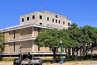
Angleton is a city in and the county seat of Brazoria County, Texas, United States, within the Houston–The Woodlands–Sugar Land metropolitan area. Angleton lies at the intersection of State Highway 288, State Highway 35, and the Union Pacific Railroad. The population was 19,429 at the 2020 census. Angleton is in the 14th congressional district, and is represented by Republican Congressman Randy Weber.

<span class="mw-page-title-main">Anahuac, Texas</span> Town in Texas, United States

Anahuac is a city in the U.S. state of Texas on the coast of Trinity Bay. The population of the city was 1,980 at the 2020 census. Anahuac is the seat of Chambers County and is situated in Southeast Texas. The Texas Legislature designated the city as the "Alligator Capital of Texas" in 1989. Anahuac hosts an annual alligator festival.

<span class="mw-page-title-main">Stowell, Texas</span> Census-designated place in Texas, United States

Stowell is an unincorporated community and census-designated place (CDP) in Chambers County, Texas, United States. The population was 1,743 at the 2020 census.

<span class="mw-page-title-main">Winnie, Texas</span> CDP in Texas, United States

Winnie is a census-designated place (CDP) in Chambers County, Texas, United States. The population was 3,162 at the 2020 census.

<span class="mw-page-title-main">Bayou Vista, Texas</span> City in Texas, United States

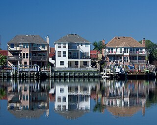
Bayou Vista is a city in Galveston County, Texas, United States. The population was 1,537 at the 2010 census. It received severe damage from Hurricane Ike on September 13, 2008.

<span class="mw-page-title-main">Dickinson, Texas</span> City in Texas, United States

Dickinson is a city in Galveston County, Texas, United States, within Houston–The Woodlands–Sugar Land metropolitan area. The population was 20,847 at the 2020 census.

<span class="mw-page-title-main">La Marque, Texas</span> City in Texas, United States

La Marque is a city in Galveston County, Texas, United States, south of Houston. The city population in 2020 was 18,030. La Marque experienced considerable growth in the 1950s, during which the city provided a general administrative and trades and crafts workforce helping to support the petrochemical complex in adjoining Texas City. It is the hometown of U.S. Senator Kay Bailey Hutchison and Norman Bulaich.

<span class="mw-page-title-main">Morgan's Point, Texas</span> City in Texas, United States

Morgan's Point is located 30 miles southeast of Houston in southeastern Harris County, Texas, United States, located on the shores of Galveston Bay at the inlet to the Houston Ship Channel, near La Porte and Baytown. As of the 2010 census, it had a population of 339. As of 2020, it has approximately 356 residents and is located within the La Porte Independent School District.

<span class="mw-page-title-main">Nassau Bay, Texas</span> City in Texas, United States

Nassau Bay is a city in Harris County, Texas, United States, bordering the outermost southeastern edge of the city of Houston. It is located in the Clear Lake Area near Galveston Bay, directly adjacent to the Lyndon B. Johnson Space Center. The population was 5,347 at the 2020 census.

<span class="mw-page-title-main">Liberty, Texas</span> City in Texas, United States

Liberty is a city in the U.S. state of Texas, within Liberty County. The population was 8,279 at the 2020 census. It serves as the seat of Liberty County.

<span class="mw-page-title-main">Baytown, Texas</span> City in Texas, United States

Baytown is a city in the U.S. state of Texas, within Harris and Chambers counties. Located in the Houston–The Woodlands–Sugar Land metropolitan statistical area, it lies on the northern side of the Galveston Bay complex near the outlets of the San Jacinto River and Buffalo Bayou. It is the sixth-largest city within this metropolitan area and seventh largest community. Major highways serving the city include State Highway 99, State Highway 146 and Interstate 10. At the 2020 U.S. census, Baytown had a population of 83,701, and it had an estimated population of 84,324 in 2022.

<span class="mw-page-title-main">Mont Belvieu, Texas</span> City in Texas, United States

Mont Belvieu is a city in Chambers County in the U.S. state of Texas. It is just north of Interstate 10 along State Highway 146. The population is currently 11,922 and was 7,654 at the 2020 census, an increase of nearly 100% from 3,835 in 2010. It is the site of the largest underground storage facility for liquefied petroleum gas in the US. The US LPG market pricing indicator is driven primarily by the Mont Belvieu market, and reported daily by the US Energy Administration.

<span class="mw-page-title-main">League City, Texas</span> City in Texas, United States

League City is a city in the U.S. state of Texas, in Galveston County, within the Greater Houston metropolitan area. The population 114,392 at the 2020 census.

Oak Island is an unincorporated community and census-designated place (CDP) in Chambers County, Texas, United States. The population was 371 at the 2020 census.

References

  1. "US Census 2020 Population Dataset Tables for all Texas counties".
  2. "U.S. Census Bureau QuickFacts: Chambers County, Texas". United States Census Bureau. Retrieved January 31, 2022.
  3. "Chambers County, Texas". United States Census Bureau . Retrieved January 30, 2022.
  4. "Find a County". National Association of Counties. Archived from the original on May 31, 2011. Retrieved June 7, 2011.
  5. Alvarez, Elizabeth Cruce (November 8, 2011). Texas Almanac 2012–2013. Texas A&M University Press. pp. Contents. ISBN   9780876112571 . Retrieved November 17, 2013.
  6. Gannett, Henry (1905). The Origin of Certain Place Names in the United States. Govt. Print. Off. pp.  74.
  7. "Human remains found after Atlas Air cargo plane crashes in Chambers Co". KTRK-TV. February 23, 2019. Retrieved February 28, 2019.
  8. "2010 Census Gazetteer Files". United States Census Bureau. August 22, 2012. Retrieved April 20, 2015.
  9. "Decennial Census of Population and Housing by Decades". US Census Bureau.
  10. "Texas Almanac: Population History of Counties from 1850–2010" (PDF). Texas Almanac. Archived (PDF) from the original on October 9, 2022. Retrieved April 20, 2015.
  11. 1 2 "P2 HISPANIC OR LATINO, AND NOT HISPANIC OR LATINO BY RACE - 2010: DEC Redistricting Data (PL 94-171) - Chambers County, Texas". United States Census Bureau .
  12. 1 2 "P2 HISPANIC OR LATINO, AND NOT HISPANIC OR LATINO BY RACE - 2020: DEC Redistricting Data (PL 94-171) - Chambers County, Texas". United States Census Bureau .
  13. "U.S. Census website". United States Census Bureau . Retrieved May 14, 2011.
  14. Leip, David. "Dave Leip's Atlas of U.S. Presidential Elections". uselectionatlas.org. Retrieved April 5, 2018.
  15. "2020 CENSUS - SCHOOL DISTRICT REFERENCE MAP: Chambers County, TX" (PDF). U.S. Census Bureau. Archived (PDF) from the original on October 9, 2022. Retrieved June 29, 2022. - Text list
  16. Texas Education Code, Section 130.186, "Lee College District Service Area". Its service area includes Goose Creek, Barbers Hill, Anahuac, and East Chambers school districts.
  17. Texas Education Code, Sec. 130.197. SAN JACINTO COLLEGE DISTRICT SERVICE AREA..
  18. "Master Plan Executive Summary Archived July 11, 2011, at the Wayback Machine ." George Bush Intercontinental Airport Master Plan. Houston Airport System. December 2006. 2-1 (23/130). Retrieved on December 14, 2010.

29°42′N94°41′W / 29.70°N 94.68°W / 29.70; -94.68