San Patricio County, Texas

Last updated

San Patricio County
San patricio courthouse.jpg
Built in 1927 (Henry T. Phelps), this is the eighth structure to serve as the San Patricio County Courthouse in Sinton.
Map of Texas highlighting San Patricio County.svg
Location within the U.S. state of Texas
Texas in United States.svg
Texas's location within the U.S.
Coordinates: 28°01′N97°31′W / 28.01°N 97.52°W / 28.01; -97.52
CountryFlag of the United States.svg United States
StateFlag of Texas.svg  Texas
Founded1836
Named for Saint Patrick
Seat Sinton
Largest city Corpus Christi
Area
  Total708 sq mi (1,830 km2)
  Land693 sq mi (1,790 km2)
  Water14 sq mi (40 km2)  2.0%
Population
 (2020)
  Total68,755
  Density97/sq mi (37/km2)
Time zone UTC−6 (Central)
  Summer (DST) UTC−5 (CDT)
Congressional district 27th
Website www.co.san-patricio.tx.us

San Patricio County is located in the U.S. state of Texas. As of the 2020 census, its population was 68,755. [1] Its county seat is Sinton. [2] San Patricio County is part of the Corpus Christi metropolitan statistical area.

Contents

History

In 1828, 200 Irish Catholic families, recruited from Ireland and the Irish population of New York City, contracted with the Mexican government to settle on 80 leagues of land in this area. By 1836, about 500 people lived in the colony on 84 Mexican land grants. During the Texas Revolution, most fled from the colony because of fighting in the area. By 1841, a small number of permanent residents had returned. When Texas was annexed by the United States in 1845, the area was stabilized by the presence of U.S. troops under General Zachary Taylor. In 1845, the county was formed (San Patricio is Spanish for Saint Patrick, the primary patron saint of the colonists' home country of Ireland), and Corpus Christi was designated as the county seat. The following year, the county south of the Nueces River was reorganized as Nueces County, and the town of San Patricio became the county seat of San Patricio County. In 1848, additional counties were formed out of San Patricio, which further reduced its size. [3]

The 1850 U.S. Census listed only 200 people in the county, including three slaves. The local economy was based on cattle raising. In the mid-1860s, more settlers moved, drawn by the cheap land. By 1870, 602 people lived in the county, and the agricultural census reported 51 farms and ranches, totaling 52,000 acres (210 km2), in the area, with about 2,400 acres (9.7 km2) described as "improved". Development of the county intensified during the early 20th century, as hundreds of farmers moved in from North Texas and other states. The population reached 7,307 by 1910, and was 11,386 by 1920; 470 farms were counted in 1910, and 757 farms in 1920. Cattle ranching remained important, but vegetables and cotton also became important. The acres planted in the cotton increased from about 15,000 acres (61 km2) in 1910 to 155,000 acres (630 km2) by 1930. [3] [4] [5]

Geography

According to the U.S. Census Bureau, the county has a total area of 708 sq mi (1,830 km2), of which 693 sq mi (1,790 km2) are land and 14 sq mi (36 km2) (2.0%) are covered by water. [6]

The Gulf of Mexico forms the eastern border of the county.

Major highways

Adjacent counties

Demographics

Historical population
CensusPop.Note
1850 200
1860 620210.0%
1870 602−2.9%
1880 1,01067.8%
1890 1,31229.9%
1900 2,37280.8%
1910 7,307208.1%
1920 11,38655.8%
1930 23,836109.3%
1940 28,87121.1%
1950 35,84224.1%
1960 45,02125.6%
1970 47,2885.0%
1980 58,01322.7%
1990 58,7491.3%
2000 67,13814.3%
2010 64,804−3.5%
2020 68,7556.1%
U.S. Decennial Census [7]
1850–2010 [8] 2010–2014 [9]
San Patricio County racial/ethnic composition
(NH = Non-Hispanic) [lower-alpha 1]
RacePop 2010 [12] Pop 2020 [13] % 2010% 2020
White (NH)27,33026,61342.17%38.71%
Black or African American (NH)9029941.39%1.45%
Native American or Alaska Native (NH)1691980.26%0.29%
Asian (NH)5068450.78%1.23%
Pacific Islander (NH)46660.07%0.1%
Some Other Race (NH)532270.08%0.33%
Mixed/Multi-Racial (NH)5501,5920.85%2.32%
Hispanic or Latino 35,24838,22054.39%55.59%
Total64,80468,755

As of the 2020 United States census, there were 68,755 people, 23,422 households, and 16,838 families residing in the county.

As of the census [14] of 2000, 67,138 people, 22,093 households, and 17,232 families resided in the county. The population density was 97 people/sq mi (37 people/km2). The 24,864 housing units averaged 36 units per square mile (14 units/km2). The racial makeup of the county was 76.76% White, 2.81% African American, 0.70% Native American, 0.63% Asian, 0.11% Pacific Islander, 15.94% from other races, and 3.05% from two or more races. About 49.42% of the population was Hispanic or Latino of any race.

Of the 22,093 households, 41.6% had children under the age of 18 living with them, 60.6% were married couples living together, 12.7% had a female householder with no husband present, and 22.0% were not families. About 18.7% of all households were made up of individuals, and 8.0% had someone living alone who was 65 or older. The average household size was 2.97, and the average family size was 3.40.

In the county, the age distribution was 31.1% under the age of 18, 10.0% from 18 to 24, 28.2% from 25 to 44, 20.2% from 45 to 64, and 10.5% who were 65 or older. The median age was 32 years. For every 100 females, there were 100.50 males. For every 100 females age 18 and over, there were 98.30 males.

The median income for a household in the county was $34,836, and for a family was $40,002. Males had a median income of $31,132 versus $20,730 for females. The per capita income for the county was $15,425. About 14.60% of families and 18.00% of the population were below the poverty line, including 23.50% of those under age 18 and 16.80% of those age 65 or over.

Communities

Cities (multiple counties)

Cities

Towns

Census-designated places

Unincorporated community

Education

School districts include:

Del Mar College is the designated community college for all of San Patricio County. [15]

Government and politics

Government

San Patricio County, like all counties in Texas, is governed by a commissioners' court. This court consists of the county judge (the chairperson of the court), who is elected county-wide, and four commissioners who are elected by the voters in each of four precincts.

The Commissioners' Court is the policy-making body for the county; in addition, the county judge is the senior executive and administrative position in the county. The Commissioners' Court sets the county tax rate, adopts the budget, appoints boards and commissions, approves grants and personnel actions, and oversees the administration of county government. Each commissioner also supervises a Road and Bridge District. [16]

County Commissioners

Office [17] NameParty
 County JudgeDavid KrebsRepublican
 Commissioner, Precinct 1Sonia LopezDemocratic
 Commissioner, Precinct 2Tom YardleyRepublican
 Commissioner, Precinct 3Lilly WilkinsonRepublican
 Commissioner, Precinct 4Howard GillespieRepublican

County Officials

Office [17] NameParty
 County AttorneyTamera Cochran-MayRepublican
 County ClerkGracie Alaniz-GonzalesDemocratic
 District AttorneySam SmithRepublican
 District ClerkHeather MarksRepublican
 SheriffOscar RiveriaRepublican
 Tax Assessor-CollectorMarcela ThormaehlenRepublican
 TreasurerApril GarciaRepublican

Constables

Office [17] NameParty
 Constable, Precinct 1Joe GaitanDemocratic
 Constable, Precinct 2Franciso CantuDemocratic
 Constable, Precinct 4Parnel HaynesRepublican
 Constable, Precinct 5Sean Orsak
 Constable, Precinct 6Kody FahrentholdRepublican
 Constable, Precinct 8Terry GonzalesDemocratic

Justices of the Peace

Office [17] NameParty
 Justice of the Peace, Precinct 1Leslie DeAsesRepublican
 Justice of the Peace, Precinct 2Danny GarzaDemocratic
 Justice of the Peace, Precinct 4Karen DiazRepublican
 Justice of the Peace, Precinct 5Nere VillarrealDemocratic
 Justice of the Peace, Precinct 6Susan PriceRepublican
 Justice of the Peace, Precinct 8Leslie PullinRepublican

County Courts

Office [17] NameParty
 County Court at Law No. 1Elizabeth WelbornRepublican
 County Court at Law No. 2Vicki Hesseltine Martino

District Courts

Office [17] NameParty
 36th District CourtStarr BauerRepublican
 156th District CourtPatrick L. FlaniganRepublican
 343rd District CourtJana WhatleyRepublican

Politics

Despite being majority-minority San Patricio county leans overwhelmingly Republican. The GOP does better than average among Latino residents in Texas, particularly south Texas. In 2022, Republicans won 40% of the Latino vote. [18] This has been as high as 48% in 2014. [19] These margins help Republicans win majority-minority districts, while Republicans in other parts of the country struggle - only garnering between 21% and 30% of the vote. Republicans appear to be increasing their Latino support from picking off specific segments: Men, rural Latinos, Rio Grande Valley, devout Catholics, Tejano and pro-life voters.

United States presidential election results for San Patricio County, Texas [20]
Year Republican Democratic Third party
No.%No.%No.%
2020 16,51663.79%8,98834.71%3871.49%
2016 13,03060.17%7,87136.35%7553.49%
2012 12,00559.79%7,85639.13%2171.08%
2008 12,40457.97%8,85441.38%1380.64%
2004 13,47463.20%7,76436.42%820.38%
2000 10,59956.68%7,84041.93%2601.39%
1996 7,67845.21%8,13247.88%1,1736.91%
1992 7,45639.48%8,20243.43%3,22917.10%
1988 9,15947.07%9,92050.98%3791.95%
1984 11,07455.48%8,83844.27%500.25%
1980 8,32647.59%8,62749.31%5413.09%
1976 5,85338.02%9,46961.51%730.47%
1972 7,17957.42%5,09740.77%2261.81%
1968 3,71729.95%6,81854.94%1,87615.12%
1964 2,18823.32%7,17676.47%200.21%
1960 3,12937.29%5,24662.52%160.19%
1956 3,30246.82%3,72852.86%220.31%
1952 3,22049.24%3,31550.69%50.08%
1948 96325.19%2,64969.29%2115.52%
1944 87822.86%2,71270.61%2516.53%
1940 98024.73%2,96374.77%200.50%
1936 48217.69%2,21381.21%301.10%
1932 40715.86%2,14283.48%170.66%
1928 1,38870.56%57929.44%00.00%
1924 98745.63%1,09750.72%793.65%
1920 30832.25%62064.92%272.83%
1916 13016.31%59474.53%739.16%
1912 17519.60%55161.70%16718.70%

See also

Related Research Articles

<span class="mw-page-title-main">Nueces County, Texas</span> County in Texas, United States

Nueces County is located in the U.S. state of Texas. As of the 2020 census, the population was 353,178, making it the 16th-most populous county in the state. The county seat is Corpus Christi. The county was formed in 1846 from portions of San Patricio County and organized the following year. It is named for the Nueces River, which marks the county's northwestern boundary with San Patricio County before emptying into its mouth at Nueces Bay north of the port of Corpus Christi. Nueces County is part of the Corpus Christi metropolitan statistical area.

<span class="mw-page-title-main">Kleberg County, Texas</span> County in Texas, United States

Kleberg County is a county in the U.S. state of Texas. As of the 2020 census, its population was 31,040. The county seat is Kingsville. The county was organized in 1913 and is named for Robert J. Kleberg, an early settler.

<span class="mw-page-title-main">Kendall County, Texas</span> County in Texas, United States

Kendall County is a county located on the Edwards Plateau in the U.S. state of Texas. In 2020 census, its population was 44,279. Its county seat is Boerne. The county is named for George Wilkins Kendall, a journalist and Mexican–American War correspondent.

<span class="mw-page-title-main">Karnes County, Texas</span> County in Texas, United States

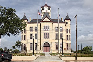
Karnes County is a county in the U.S. state of Texas. As of the 2020 census, the population was 14,710. Its county seat is Karnes City. The county is named for Henry Karnes, a soldier in the Texas Revolution. The former San Antonio and Aransas Pass Railway passed through Karnes County in its connection linking San Antonio with Corpus Christi.

<span class="mw-page-title-main">Jim Wells County, Texas</span> County in Texas, United States

Jim Wells County is a county in the U.S. state of Texas. As of the 2020 census, its population was 38,891. The county was founded in 1911 and is named for James B. Wells Jr. (1850–1923), for three decades a judge and Democratic Party political boss in South Texas.

<span class="mw-page-title-main">Bee County, Texas</span> County in Texas, United States

Bee County is a county located in the U.S. state of Texas. It is in South Texas and its county seat is Beeville. As of the 2020 census, its population was 31,047. The Beeville, TX micropolitan statistical area includes all of Bee County. The county was founded December 8, 1857, and organized the next year. It is named for Barnard E. Bee, Sr., a secretary of state of the Republic of Texas.

<span class="mw-page-title-main">Aransas County, Texas</span> County in Texas, United States

Aransas County is a county located in the U.S. state of Texas. It is in South Texas and its county seat is Rockport.

<span class="mw-page-title-main">Mathis, Texas</span> City in Texas, United States

Mathis is a city in San Patricio County, Texas, United States. The population was 4,942 at the 2010 census.

<span class="mw-page-title-main">Sinton, Texas</span> City in Texas, United States

Sinton is a city in and the county seat of San Patricio County, Texas, United States. The population was 5,504 at the 2020 census. It was founded in 1886 and was named in honor of David Sinton, a influential business owner and rancher.

<span class="mw-page-title-main">Aransas Pass, Texas</span> City in Texas, United States

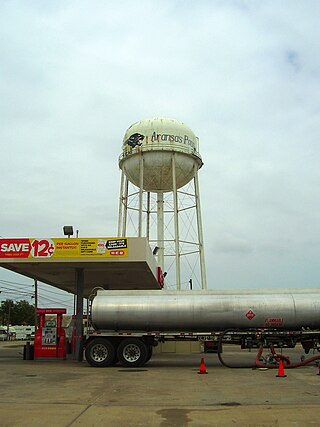
Aransas Pass is a city in Aransas, Nueces, and San Patricio Counties in the U.S. state of Texas. The population was 8,011 at the 2021 Census.

<span class="mw-page-title-main">Corpus Christi, Texas</span> City in Texas, United States

Corpus Christi is a coastal city in the South Texas region of the U.S. state of Texas and the county seat and largest city of Nueces County with portions extending into Aransas, Kleberg, and San Patricio counties. It is 130 miles (210 km) southeast of San Antonio and 208 miles (335 km) southwest of Houston. Its political boundaries encompass Nueces Bay and Corpus Christi Bay. Its zoned boundaries include small land parcels or water inlets of three neighboring counties.

<span class="mw-page-title-main">Ingleside, Texas</span> City in Texas, United States

Ingleside is a city primarily in San Patricio County, with small parts in Nueces County, in the U.S. state of Texas. Its population was 9,519 at the 2020 census.

<span class="mw-page-title-main">Portland, Texas</span> City in Texas, United States

Portland is a city primarily located in San Patricio County with some water bodies extending into Nueces County in the U.S. state of Texas. Its population was 20,383 as of the 2020 United States census. Current population calculated by the City of Portland is 22,620. Portland is a suburb of Corpus Christi, located on the north shore of Nueces and Corpus Christi Bays.

<span class="mw-page-title-main">San Patricio, Texas</span> City in Texas, United States

San Patricio is a city in San Patricio counties in the U.S. state of Texas. The population was 384 at the 2020 census.

<span class="mw-page-title-main">Coastal Bend Council of Governments</span>

The Coastal Bend Council of Governments (CBCOG) is a voluntary association of cities, counties and special districts in South Texas.

<span class="mw-page-title-main">Texas State Highway 361</span> State highway in Texas

State Highway 361 is a state highway in San Patricio and Nueces counties that runs from Gregory in southern Texas, near Corpus Christi, east and south to Padre Island on the Gulf of Mexico coast.

<span class="mw-page-title-main">Corpus Christi metropolitan area</span>

The Corpus Christi metropolitan statistical area is a metropolitan area in South Texas that covers two counties, Nueces, and San Patricio. As of the 2000 census, the MSA had a population of 413,280.

The Corpus Christi–Kingsville–Alice Combined Statistical Area is made up of six counties in South Texas. The statistical area consists of the Corpus Christi Metropolitan Statistical Area, the Kingsville Micropolitan Statistical Area, and the Alice Micropolitan Statistical Area. As of the 2010 census, the CSA had a population of 501,500.

Banquete is a census-designated place (CDP) in Nueces County, Texas, United States. Banquete is located at the intersection of State Highway 44 and FM 666, 23 miles west of Corpus Christi. Banquete should not be confused with Rancho Banquete, a census-designated place situated several miles west of the community.

Calallen is a former town that existed until the 1960s. Today, Calallen is an outlying portion of the larger city of Corpus Christi. It is located in Nueces County, in the Coastal Bend region of Texas. It is bound to the north by the Nueces River, which also marks the boundary between Nueces County and San Patricio County.

References

  1. "QuickFacts: San Patricio County, Texas". U.S. Census Bureau . Retrieved March 27, 2022.
  2. "Find a County". National Association of Counties. Retrieved June 7, 2011.
  3. 1 2 San Patricio County from the Handbook of Texas Online
  4. Guthrie, Keith; San Patricio County Historical Commission (1986). The history of San Patricio County. Austin, Texas: Eakin Publications. LCCN   87108045. OCLC   1154053506.
  5. Stewart, Bennie L. (1960). History of San Patricio County. Kingsville, Texas. OCLC   27020541.{{cite book}}: CS1 maint: location missing publisher (link)
  6. "2010 Census Gazetteer Files". United States Census Bureau. August 22, 2012. Retrieved May 10, 2015.
  7. "Decennial Census of Population and Housing by Decades". US Census Bureau.
  8. "Texas Almanac: Population History of Counties from 1850–2010" (PDF). Texas Almanac. Archived (PDF) from the original on October 9, 2022. Retrieved May 10, 2015.
  9. "State & County QuickFacts". United States Census Bureau. Retrieved December 24, 2013.
  10. https://www.census.gov/ [ not specific enough to verify ]
  11. "About the Hispanic Population and its Origin". www.census.gov. Retrieved May 18, 2022.
  12. "Explore Census Data". data.census.gov. Retrieved May 21, 2022.
  13. "Explore Census Data". data.census.gov. Retrieved May 21, 2022.
  14. "U.S. Census website". United States Census Bureau . Retrieved May 14, 2011.
  15. Texas Education Code Sec. 130.177. DEL MAR COLLEGE-CORPUS CHRISTI JUNIOR COLLEGE DISTRICT SERVICE AREA.
  16. "Dallas County". www.dallascounty.org.
  17. 1 2 3 4 5 6 "San Patricio County, TX Elections" (PDF).
  18. "Texas Republicans lost Latino voters support in election setback". Dallas News. November 10, 2022. Retrieved January 12, 2023.
  19. Krogstad, Jens Manuel (November 7, 2014). "Hispanic Voters in the 2014 Election". Pew Research Center's Hispanic Trends Project. Retrieved January 12, 2023.
  20. Leip, David. "Dave Leip's Atlas of U.S. Presidential Elections". uselectionatlas.org. Retrieved July 30, 2018.
  1. Note: the US Census treats Hispanic/Latino as an ethnic category. This table excludes Latinos from the racial categories and assigns them to a separate category. Hispanics/Latinos can be of any race. [10] [11]

28°01′N97°31′W / 28.01°N 97.52°W / 28.01; -97.52