
Towson is an unincorporated community and a census-designated place in Baltimore County, Maryland, United States. The population was 55,197 as of the 2010 census. It is the county seat of Baltimore County and the second-most populous unincorporated county seat in the United States.

Cheverly is a town in Prince George's County, Maryland, United States, located very close to Washington, D.C., though not bordering it directly. The town was founded in 1918 and incorporated in 1931. Per the 2020 census, the population was 6,170. Cheverly borders the communities of Tuxedo, Chapel Oaks, Landover, Landover Hills, Villa Heights, and Bladensburg.

Hampden is a neighborhood located in northern Baltimore, Maryland, United States. Roughly triangular in shape, it is bounded to the east by the neighborhood Wyman Park, to the north by Roland Park at 40th and 41st Street, to the west by the Jones Falls Expressway, and to the south by the neighborhood Remington. The Homewood campus of the Johns Hopkins University is a short distance to the east.

Abell is a neighborhood located in the north-central area of Baltimore, Maryland, United States. It is considered to be part of Charles Village, Baltimore.
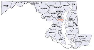
There are more than 1,500 properties and districts listed on the National Register of Historic Places in the U.S. State of Maryland. Each of the state's 23 counties and its one county-equivalent has at least 20 listings on the National Register.

Maryland Route 7 (MD 7) is a collection of state highways in the U.S. state of Maryland. Known for much of their length as Philadelphia Road, there are five disjoint mainline sections of the highway totaling 40.23 miles (64.74 km) that parallel U.S. Route 40 (US 40) in Baltimore, Harford, and Cecil counties in northeastern Maryland. The longest section of MD 7 begins at US 40 just east of the city of Baltimore in Rosedale and extends through eastern Baltimore County and southern Harford County to US 40 in Aberdeen. The next segment of the state highway is a C-shaped route through Havre de Grace on the west bank of the Susquehanna River. The third mainline section of MD 7 begins in Perryville on the east bank of the Susquehanna River and ends at US 40 a short distance west of the start of the fourth section, which passes through Charlestown and North East before ending at US 40, just west of Elkton. The fifth segment of the highway begins at South Street and passes through the eastern part of Elkton before reconnecting with US 40 east of Elkton and west of the Delaware state line.

Maryland Route 41 is a state highway in the U.S. state of Maryland. Known for most of its length as Perring Parkway, the state highway runs 6.75 miles (10.86 km) from MD 147 in Baltimore north to Waltham Woods Road in Carney. MD 41 is a four- to six-lane divided highway that connects portions of Northeast Baltimore, including Morgan State University, with Parkville and Interstate 695 (I-695). The state highway is maintained by the Maryland State Highway Administration in Baltimore County and the Baltimore City Department of Transportation in the city, where it is unsigned. MD 41 was built in the early to mid-1960s, largely to relieve congestion on portions of neighboring Old Harford and Harford Roads during the period of rapid post-World War II growth in the area.

Maryland Route 147 is a state highway in the U.S. state of Maryland. Known as Harford Road, the state highway runs 18.82 miles (30.29 km) from U.S. Route 1 and US 40 Truck in Baltimore north to US 1 and US 1 Business in Benson. MD 147 is an alternate route to US 1 between Baltimore and Bel Air, the county seat of Harford County. The state highway is the main street of several neighborhoods in Northeast Baltimore and the Baltimore County suburbs of Parkville and Carney. MD 147 is maintained by the Maryland State Highway Administration in Baltimore and Harford counties and by the Baltimore City Department of Transportation within the city. Harford Road was a pair of turnpikes before the Baltimore–Carney portion of the highway was designated one of the original state roads. The Baltimore County section of MD 147 was constructed in the early 1910s and widened multiple times in the late 1920s and 1930s. The section of the state highway in Harford County was built in the late 1920s.

Hamilton Hills is a mixed-use suburban neighborhood located in the northeastern corner of Baltimore City, Maryland. Hamilton Hills represents a section of Hamilton, a larger historic area that includes other neighborhoods in Northeast Baltimore. The neighborhood's borders are Old Harford Road and Harford Road to the east, Echodale Avenue to the south, Perring Parkway to the west and the Baltimore County line to the north. The main thoroughfare in Hamilton Hills is Harford Road, which has been an integral part of the area's history.

U.S. Route 1 (US 1) is the easternmost and longest of the major north–south routes of the older 1920s era United States Numbered Highway System, running from Key West, Florida, to Fort Kent, Maine. In the U.S. state of Maryland, it runs 81 miles (130 km) from the Washington, D.C. line to the Pennsylvania state line near the town of Rising Sun.
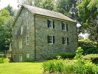
The Mill Green Historic District is a National Register of Historic Places listed community located in Harford County, Maryland. The district consists of a small cluster of privately owned historic homes and buildings including a historic mill. The district is located at the junction of Mill Green Road and Prospect Road. Broad Creek flows through the district. The historic district designation was established in 1993.

Maryland Route 22 is a state highway in the U.S. state of Maryland. The state highway runs 12.91 miles (20.78 km) from U.S. Route 1 Business and MD 924 in Bel Air east to an entrance to Aberdeen Proving Ground in Aberdeen. MD 22 is the main connection between the county seat of Bel Air and Aberdeen, which is the largest city in Harford County. The state highway also provides the primary route between Interstate 95 (I-95) and Aberdeen Proving Ground.

Clifton Park is a public urban park and national historic district located between the Coldstream-Homestead-Montebello and Waverly neighborhoods to the west and the Belair-Edison, Lauraville, Hamilton communities to the north in the northeast section of Baltimore, Maryland, United States. It is roughly bordered by Erdman Avenue to the northeast, Sinclair Lane to the south, Harford Road to the northwest and Belair Road to the southeast. The eighteen-hole Clifton Park Golf Course, which is the site of the annual Clifton Park Golf Tournament, occupies the north side of the park.
Old Harford Road, one of the oldest continuously used rights-of-way in central Maryland, United States, is a southwest–northeast thoroughfare in northeast Baltimore City and eastern Baltimore County.

Ednor Gardens-Lakeside is a large community in northeast Baltimore, Maryland. It is bounded by 33rd Street to the south, Hillen Road to the east, Ellerslie Avenue to the west, and Argonne Drive, The Alameda, Loch Raven Boulevard, and Roundhill Road to the north. Ednor Gardens was part of a large planned community that was built out from the 1920s through the 1950s by Edward Gallagher, one of Baltimore's most prolific homebuilders at the time. It is notable among its neighbors for the quality of the homes and extensive landscaping. Until it was torn down in 2002, Memorial Stadium was located in Ednor Gardens-Lakeside.

Mayfield is a quaint and historic community in northeast Baltimore, Maryland. It is bounded by Erdman Avenue on the south, Chesterfield Avenue on the north, Crossland Avenue on the east and Lake Montebello on the north and west. Homeowners belong to the Mayfield Improvement Association.
Waltherson is a neighborhood located in Northeast Baltimore, Maryland, United States that runs between Harford Road to Belair Road and from Hamilton Ave in the north and Southern Ave in the south. It was later expanded to include the neighborhood of Wilson Heights extending its boundaries along Belair Road to Moravia Road to achieve the boundaries currently seen on Baltimore City's CityView page.

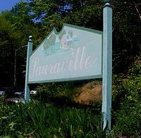
Beverly Hills is a neighborhood in the Northeast District of Baltimore, located between the neighborhoods of Moravia-Walther, Arcadia and Lauraville. Its boundaries are drawn by Harford Road (west), Weaver Avenue (south), Harcourt Road (east), Moravia Road (northeast) and Grindon Avenue (north).


